|
Setting Day - Where Are We Going
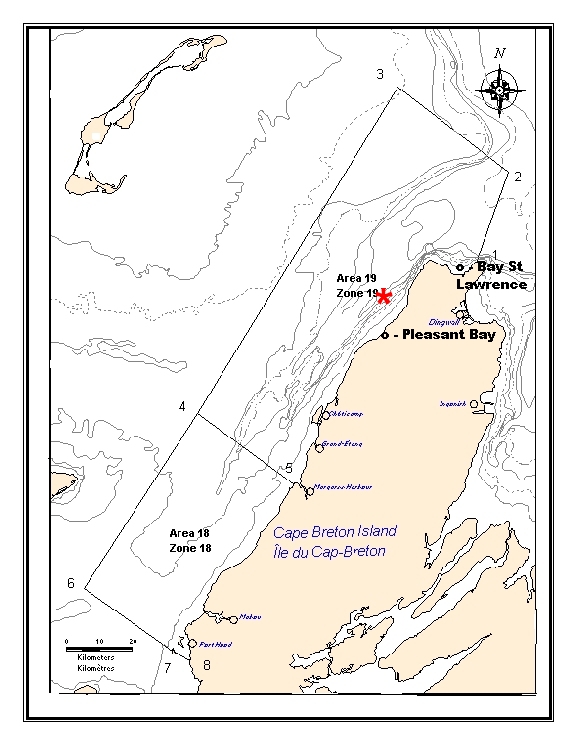
The map below shows how far we have traveled from our home port. To save fuel cost we chose to go out of Pleasant Bay instead of Bay St Lawrence (made the switch three days into the season). Instead of spending 3+ hours (from Bay St. Lawrence) to get to our traps we were taking less than 90 minutes (from Pleasant Bay.). This saves over 3 hours of steaming in and out, and at a rate of 7 gallons of fuel per hour the savings add up.
The Red dot shows a very rough location where we started the season. The Wendy Helen's home port is Bay St. Lawrence but it can go anywhere within Area 19 and use any port. Please take note of the scale at the bottom left of the figure. At Pleasant Bay it is approaching 30 km to reach the Area 19 boundary.
How would anyone know if you went outside the boundary? This year all vessels are being tracked by "black boxes". These boxes are transmitting the location of all vessels to a monitoring agency.
Next "Setting Day - Photos along the way"
|